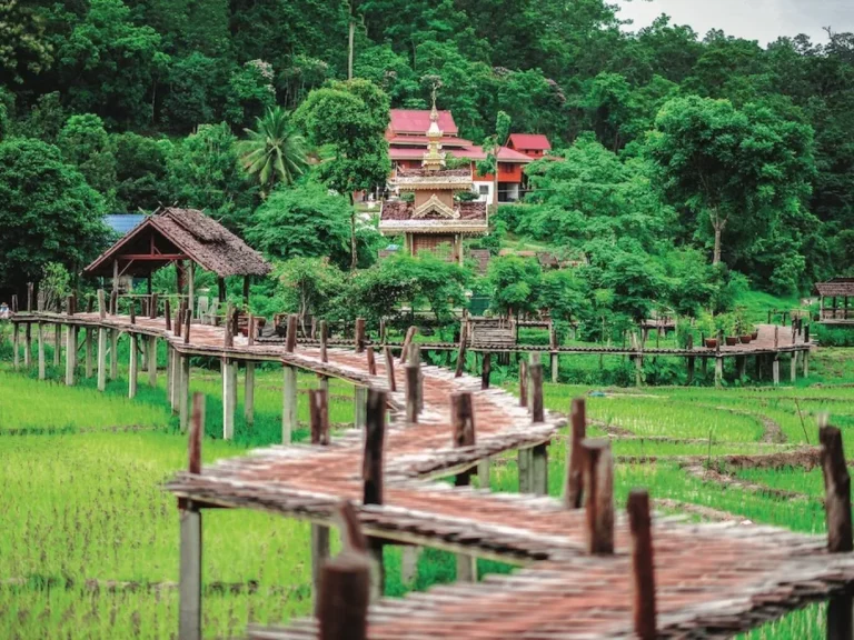
Riding to Doi Inthanon: A Scooter Day Trip to the Roof of Thailand
Most people get to Doi Inthanon eventually. Mae Kampong first, usually, maybe the Samoeng Loop after that, and then one morning somebody’s at our rental counter asking how long it takes to get up the big one. Highest mountain in Thailand. A bit over 100km from the city, and the whole second half of that is uphill. Long day on a scooter, no way around that — but a cracking one, if you’ve got the right bike under you and a jacket in the seat box. My wife and I rode it ourselves, stretched over two days with a night at a homestay halfway up, and that’s how we’d tell anyone to do it if they can spare the time.
Which Scooter to Rent for Doi Inthanon
Sort this first — it’s the part my wife and I care about most when we hand over the keys. From the park gate to the top it’s 48km of climbing, pretty much without a break. Chom Thong sits at roughly 300 metres. The summit is 2,565. A 110cc will crawl up there in the end, sounding miserable on the steep bits, but going up was never the real problem. Coming down is. Smaller engines don’t hold you back much on a long descent, so the brakes end up doing all of it.
125cc automatic, one rider — that’s the bare minimum. What we’d actually rent you is a 155: an NMAX, an Aerox, a PCX 160. Two up? Then the 155 is the minimum, not the upgrade. On a foreign license, pack the International Driving Permit. Park road or not, it’s a public road.
Getting There: Chiang Mai to Chom Thong
First half’s the dull part, to be fair. South on Route 108 — Hang Dong, San Pa Tong — wide and flat for about 58km. Trucks. Pickups. Songthaews pulling in and out without much warning. Keep left and keep your eyes up; a straight road gets boring fast and that’s when people drift.
At Chom Thong you turn right onto Route 1009 and it starts going up almost straight away. Fill the tank before that turn. Inside the park you’ve basically got one small village around km 30 selling fuel, and you don’t want to roll in on fumes hoping it’s open.
Old City to the summit is an hour and a half to two hours if you just ride. Nobody just rides, though.
Into the Park: Fees, Waterfalls and a Quieter One
You pay at the main checkpoint, around km 8. 300 baht for foreign adults. 150 for kids. Another 20 for the bike. Cash only. Keep the ticket handy — there’s a second checkpoint further up.
Mae Klang Waterfall is just past that first gate, barely a couple of minutes’ walk from the car park. Wide and low. Picnic mats everywhere at the weekend, and a small pack of resident dogs who’ll escort you down to the water whether you asked or not.
Wachirathan, around km 21, is the one most people are here for. You’ll hear it before you’ve got the helmet off. One big, heavy drop over dark granite, a viewing deck close enough to get soaked on a high-water day, and grilled corn at the stalls by the car park. It’s at its best late in the rains into November, when there’s still loads of water but the sky’s cleared.
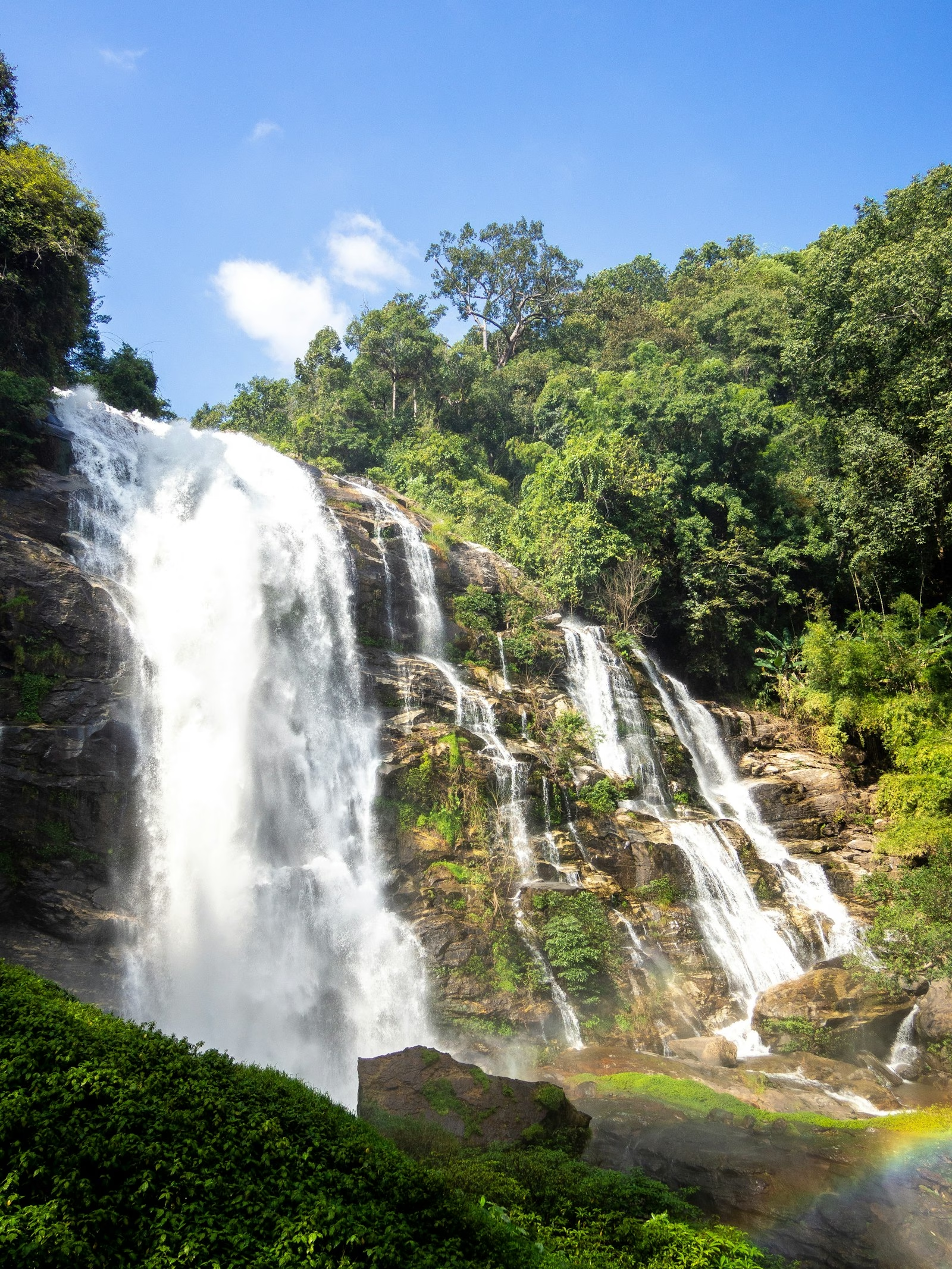
For something with nobody else at it, go looking for Mae Pan Waterfall. It’s over on the Mae Chaem side of the park, down the road that branches off towards Mae Chaem below the summit — punch it into Google Maps, because it’s easy to miss. Your park ticket covers it. From the parking spot it’s a 15 to 30 minute walk through bush, steep in places, slippery after rain, and the path isn’t always obvious. At the end: a tall fall, a pool you can swim in, and very often nobody else there. Wear shoes with grip, not flip-flops.
Around Km 31: Royal Project, Hmong Market and Mae Klang Luang
Around km 30–31, past the park headquarters, the ride starts to feel different. Cooler. Thicker forest. Karen and Hmong villages that were here long before the park — about 4,500 people live inside its boundaries.
The Hmong market is strung along both sides of the road. Dried fruit. Pickled everything. Strawberries in the cool season. Just off the road is the Royal Project research station. We had lunch at its restaurant — the Inthanon Royal Project Restaurant, sat right in the middle of the gardens, open 9am to 4pm. Friendly staff, cool air, and the fried buns are the thing everyone seems to order. Heads up: the research station charges its own entry on top of your park ticket, so you pay twice. For coffee we pulled in at The Garden Inthanon Café nearby. It’s a really nice spot — a flower garden, mountain air, and it opens at 7am, so it works as a first stop before you push on to Kew Mae Pan.
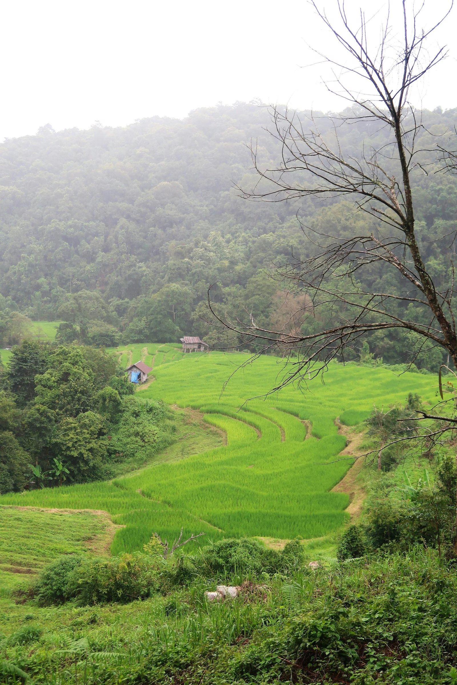
Turn off for Ban Mae Klang Luang and you drop down into a Karen village of rice terraces and home-grown Arabica. Flooded around June. Deep green by September. Gold from October into November. Mae Klang Luang Coffee House (8am–5pm) grinds and brews beans from the surrounding slopes and sells bags to take home.
Where We Stayed and Ate: Motho Homestay and Baan Deesher
We slept at Motho Homestay, right on the Inthanon road not far from Mae Klang Luang, looking out over the rice fields in the valley. Worth saying up front: this is a homestay. Not a hotel. There’s no lobby, no porter, nobody in a uniform reading from a script. What you get instead is a family-run place where the staff actually talk to you — warm, easy-going, and properly helpful with anything we asked about, from food to where to go next. If that friendly local Thai welcome is what you’re after, it’s great. If you need a formal hotel experience, book one down in the city. The rooms are simple and clean. Nights are properly quiet, and in the morning you wake up to the paddies. They cook dinner and breakfast on site, which matters up here — once it’s dark, you really don’t want to be back on the bike.
The best meal of the trip, though, was Italian. Of all things. Baan Deesher (บ้าน ดีเชอ) is just down the road from Motho, open 11am to 10pm every day, and the way in is a narrow concrete lane — take it slow on the bike. From outside it doesn’t look like much, and you could easily ride straight past. Don’t. The chef is Thai and spent years cooking in an Italian restaurant down in Chiang Mai before opening his own, and it shows — the food is a seriously high standard, the kind you’d be happy to find in the middle of Chiang Mai, never mind halfway up a mountain. Lovely people running it, too.
The Twin Pagodas and Kew Mae Pan
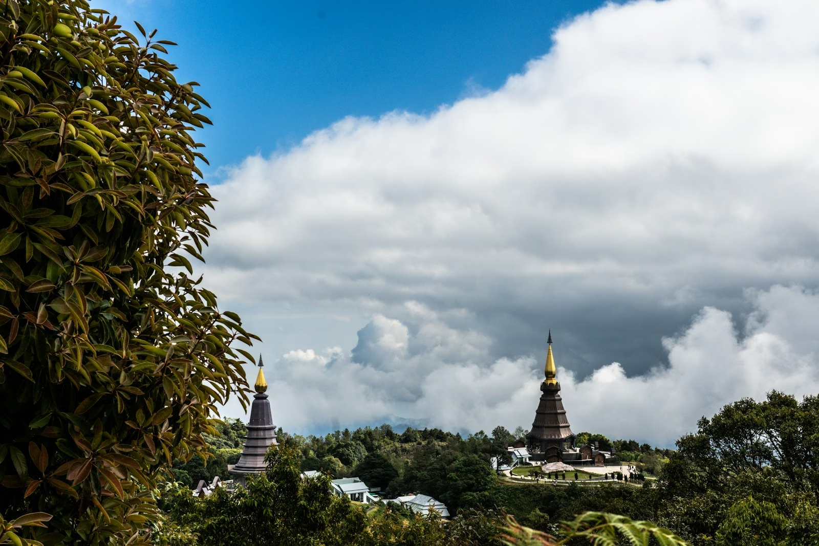
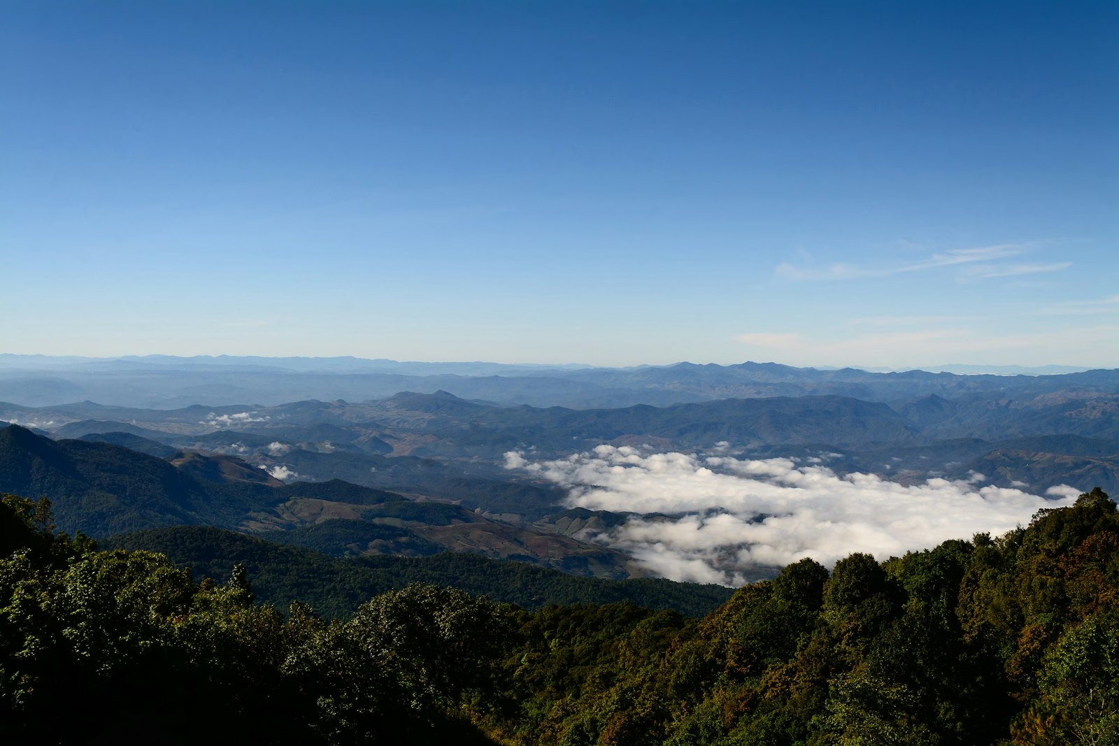
Around km 41 the twin royal pagodas show up — Phra Mahathat Naphamethanidon and Phra Mahathat Naphaphon Phumisiri, built by the Royal Thai Air Force for the King’s and Queen’s 60th birthdays. Separate ticket from the park; last we checked, around 100 baht. Most people spend longer in the flower gardens than at the pagodas. On a clear morning you get ridge after ridge rolling west. On a cloudy one you can barely see the other pagoda.
Just past them, from around km 42, is Kew Mae Pan. Roughly a three-kilometre loop along a grassy ridge and through cloud forest, with a steep, stair-heavy section that catches unfit walkers out. Allow an hour and a half to three hours. Two catches: it’s only open November to the end of May, and you walk it with a local guide — 200 baht per group, arranged at the trailhead, gates from 6am. Get there early in cool season, before the tour vans.
When you come off the trail, the noodle shop right by the trailhead car park — the sign reads ชมวิว ก๋วยเตี๋ยวแม่ปาน — does a hot bowl of noodles that’s exactly what you want at that temperature. The salapao buns from the stall next door are the better bet.
The Summit and the Ang Ka Trail
Km 48 and you’re out of road. The top itself is a bit of a letdown — the highest point is in the trees. A sign. A queue of people waiting to photograph the sign. A small chedi holding the remains of King Inthawichayanon, one of the last kings of Chiang Mai and the man the mountain’s named after.
Make time instead for the Ang Ka nature trail, just below. About 360 metres of boardwalk through cold, dripping, moss-covered cloud forest. Rhododendrons. Ferns sprouting out of tree trunks. Mist caught in the branches most mornings. Ten minutes, flat and easy.
Right by the forest is Baan Kafé, a tiny coffee spot open 7am to 4pm, and we stopped there to warm up. Good coffee, a nice little place, and about as high as you can get a cup in Thailand. Hold it with both hands. The summit’s cold year-round, it can get close to freezing overnight in the cool season, and late December into January there’s frost on the grass. Even in April you’ll want a windproof jacket.
The Ride Back Down
Coming down takes more concentration than going up. 48km, nearly all downhill, more than 2,000 metres to lose. On a descent that long the brakes get hot, and hot brakes fade — the lever goes soft right when you need it firm.
Roll off the throttle and let the engine hold your speed. Brake early and gently before the corner, not hard halfway round it. Use both brakes and don’t sit on them the whole way down. Pull in at Wachirathan and let everything cool off before the second half.
Fog’s the other one. Higher up, cloud rolls across the road with no warning. Lights on, slow right down, stay well left — the pickups coming up won’t always see you in time.
Back in the flat, one more stop before the last hour to the city. Huuan Cafe & Bakery in Chom Thong pulls proper espresso on a serious Slayer machine and bakes its own croissants, shio pan and tiramisu. Closed Mondays, shuts at 5pm. Wat Phra That Si Chom Thong, dating back to the 1400s, is right in town too, and nearly all the Inthanon traffic drives straight past it.
When to Go and What to Bring
November to February is peak season. Clear skies, cool air, Kew Mae Pan open, terraces gold at the start and frost at the top by mid-winter. Weekends get packed, so go on a weekday if you can. Late February through April is burning season — the smoke often wipes out the views. June to October means waterfalls at full power and the greenest terraces, but slippery roads, afternoon storms, and no Kew Mae Pan.
Go early. On the road by 7am, you’ll beat the tour groups to the top and be back down before the afternoon cloud rolls in. Riding the 1009 down in the dark — we wouldn’t, not unless you know it well.
What to bring:
- A warm, windproof jacket, long trousers and closed shoes with decent grip — gloves in the cool season
- A rain jacket from June to October
- Cash for fees, fuel, food, the research station and the Kew Mae Pan guide
- Your IDP, license and the bike’s rental papers
Is Doi Inthanon Worth the Ride?
Yes — give it a full day at the very least, two if you can, and rent the right bike. At a bit over 200km there and back, it asks more of you and the scooter than Mae Kampong or the Samoeng Loop ever will. What you get back: the highest point in the country, a waterfall you might have to yourself, a proper Italian dinner where you’d least expect one, coffee in a cloud forest, and a road that just gets better the higher it goes. Leave early. Fill up in Chom Thong. Take the descent slow. We got home cold, knackered, and glad we’d done it. You will too.